Central Canal Towpath

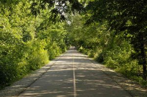
The Central Canal Towpath is a scenic path, including both paved and dirt and crushed limestone sections. Good starting points include Butler University (just down the sidewalk from Hinkle Fieldhouse along 52nd street), farther northeast at the intersection of Broad Ripple Avenue and College Avenue, and at the northeastern end where the path ends at the Monon Trail. The path is best maintained in the middle third between 52nd and Michigan Road, which is in the heart of the Butler campus. This area is also the most popular section of the Canal. Continuing southwest is still very nice, but not quite as pretty to look at, although it does lead to the 100 Acres art park. The northeastern third of the towpath can get a little narrow, but it’s quite nice. You are likely to run into ducks and geese. We’ve also seen deer, foxes, turtles, blue heron, muskrats, and beavers.
The round trip from Broad Ripple to 30th street and back is about 10 miles, although the towpath has now been extended southwest to Burdsal Parkway. A very nice stone marker showing many landmarks and the distances between them can be found at 52nd Street.
Fall Creek Trail
The Fall Creek Trail is an asphalt path that runs along the creek. It is popular with families and many runners and skaters. The scenery is dominated by large trees and the trickle of the creek. The trail connects to the Monon Trail and runs northeast to the edge of Ft. Harrison state park and southwest to near Ivy Tech. The path will eventually be about 22 miles long. It is marked at 1/4 mile increments.
Eagle Creek Park
Eagle Creek Park is one of the largest city-owned parks in the nation and probably the best place to run trails within the city. The park is located on the northwest side of Indianapolis and includes 5K, 8K, and 10K certified road courses along with an uncertified 7K course that all begin near the beach parking lot (yes, there is a beach). Each course is marked with road signs, but the markers denoting the end of each route are no longer there. Go past the starting point perhaps 50 yards to roughly reach the end of the routes. The terrain is flat in places and gently rolling in others.
There are also many miles of dirt trails for the off-road crowd. The longest trail, the red trail, is about a 6.75 mile loop. However, there are also several other shorter trails in the park. Ask for a map at the gate so you can plan your distances. And speaking of the gate, there is a charge for admission, but it’s worth it. Eagle Creek Park hours vary during the year.
Year-round porta potties are available near the 71st Street and 56th Street entrances. During the warmer months, numerous additional porta potties and permanent restrooms are also available.
Monon Trail

The Monon Trail is the main “Rails to Trails” path from Indy Parks. It is open 24 hours a day in Indianapolis, from dawn to dusk in Carmel, from sunrise to sunset in Westfield, and TBD in Sheridan, stretching a total of 27 miles. The path is smooth asphalt, often lined with trees on both sides. There are a few beautiful bridges and countless backyards into which to peek. The northern endpoint is at 236th Street in Sheridan, IN. The southern end meets the Cultural Trail in Indianapolis. It’s possible to take the Cultural Trail west to the center of downtown Indianapolis. While the entire trail should be safe during the day, women who are unfamiliar with the area and running alone may want to stay north of 52nd Street or run along the Cultural Trail unless the Monon Trail is somewhat busy.
The smoothness and “hipness” of the Monon Trail brings out everyone within a bike ride or skate of any access point. On the weekends and nice evenings, the path can be packed with families cruising along, shoulder to shoulder, walking off dinner. If you are out for speed, go during off hours. But if you are out for people watching, you will be quite entertained. Take your time, start and end in Broad Ripple, and when you’re done, plop down on one of the benches and shoot the breeze. Then maybe walk over for a snow cone, ice cream, or dinner at one of the local restaurants.
Pleasant Run Trail
The Pleasant Run Trail is a paved 8.4 mile trail located on the southeast side of town connecting Ellenberger Park to Garfield Park and the White River.
White River Wapahani Trail
The main section of the White River Wapahani Trail runs from 38th Street south past White River State Park, with the trail eventually expected to connect to Southwestway Park. Currently, it links with the Central Canal Towpath, the southern segment of the Fall Creek Trail, and the Downtown Canal Walk, and it will eventually link to the Eagle Creek Trail and possibly the Pleasant Run Trail. Trail users can also get to the Monon Trail via the Central Canal Towpath or a cross town connection on St. Clair Street.
Canal Walk – The Zoo Loop
The zoo loop is another popular race route, but it is also a wonderful “Heart of the City” run. There are 2 routes, a 3.3 and a 5 miler. Start at the corner of Capitol and Washington, go west to the zoo, then north along White River Parkway. For the 3.3 loop, turn right on New York and go past the Michael A. Carroll Track and Soccer Stadium and the Natatorium. For the 5 miler, turn right on 10th Street, past Wishard Hospital and the Canal Overlook, then loop around Monument Circle. If you can find it, take the limestone walkway behind the Indianapolis Zoo.
Fort Ben
Fort Benjamin Harrison (also known as Fort Ben or Fort Harrison State Park), formerly a military installation since 1903, is now a state park and nature preserve. The park is located on the northeast side of Indianapolis (technically Lawrence, IN) and is most easily accessed from interstate 465 then east on 56th Street. The park entrance is at the intersection of Post and 59th Street where you should be able to pick-up a map of the roads and trails. There are restricted areas, but also still plenty of nice running roads and trails. The loop around the duck pond is paved and has some good hills. The Fall Creek Trail is scenic and has a couple of very steep hills. The Lawrence Creek trail is a bit more friendly with its wide path and moderate terrain.
Additions and Corrections
We do our best to keep this page up-to-date. If you see information that is out-dated or have another running location you feel belongs on this page,,then email the location to us, and we’ll consider adding it here.

